|
|
|||||||||||
|
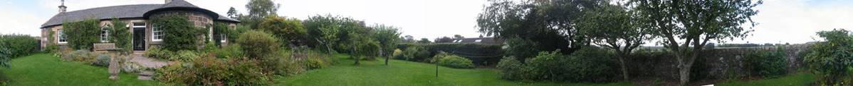
Personal
Website of Julie and Lance Intended
for our family and friends: to keep them up with our adventures |
|||||||||||
|
|
|
|
|
|
|
|
|
|
|
|
|
|
Some of Julie and Lance’s Walking Routes: kml and gpx
|
|||||||||||
|
|
|||||||||||
|
North
Highlands: |
|||||||||||
|
|
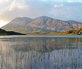
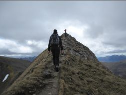
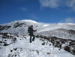
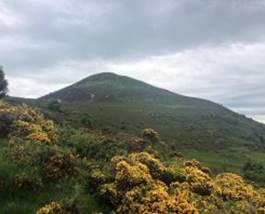
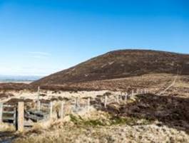
Arkle (near Scourie): Linear walk. Return
Distance 10-miles. Accent 3200ft. Around 5-hours. Conditions: good track most of the way. At times
steep walking, but no scrambling required. Click the photo for a zipped file of gpx and kml. |
||||||||||
|
|
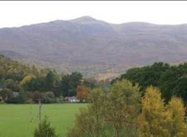
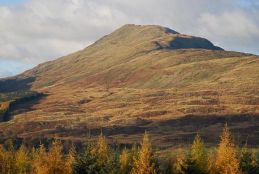
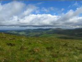
Beinn a’ Bha’ach Ard (near Cannich):
Distance 10-miles. Accent 3000ft. Around 5-hours. Conditions: a fine walk
on some good tracks and open hill side. Click the photo for a zipped file of gpx and kml. |
||||||||||
|
|
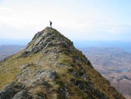
Ben Stack (near Scourie): Distance 7.5-miles.
Accent 2500ft. Around 4-hours. Conditions: one of the best small mountains in
the British Isles, with fabulous views. Click the photo for a zipped file of gpx and kml. |
||||||||||
|
|
Ben More Assynt and Conival
(near Lochinver): Distance 11-miles. Accent 3800ft.
Around 6-hours. Conditions: one of the harder routes here; a
great mountain walk. Click the photo for a zipped file of gpx and kml. |
||||||||||
|
South
Highlands: |
|
||||||||||
|
|
Ben Ledi Circuit (near Callander): Distance 6.5-miles. Accent 2700ft. Around
4-hours. Conditions: the track north of the summit can be
very boggy. Click the photo for a zipped file of gpx and kml. |
||||||||||
|
|
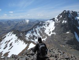
Ben Nevis via Carn Mor Dearg (near Fort William): Distance
13-miles. Accent 5400ft. Around 7.5-hours. Conditions: the hardest route in our list, this
is the best route up Britain’s highest summit. Click the photo for a zipped file of gpx and kml. |
||||||||||
|
|
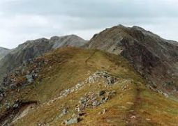
The Devil’s Ridge (near Fort William): Distance
6-miles. Accent 3700ft. Around 4-hours. Conditions: a mountain ridge walk with a degree
of exposure – a Scottish classic. Click the photo for a zipped file of gpx and kml. |
||||||||||
|
|
Ben Vrackie (near
Pitlochry): Distance 5.6-miles. Accent 2200ft. Around 3-hours. Conditions: a well-marked route up to a prominent
summit. Click the photo for a zipped file of gpx and kml. |
||||||||||
|
Fife and
Perthshire: |
|
||||||||||
|
|
Darn Walk, Ben Gunn’s Cave (possibly the
inspiration for R.L. Stevenson, Treasure Island) and Glen Road Loop (between
Bridge of Allan and Dunblane): Distance 7-miles. Accent
900ft. Around 3-hours. Conditions: easy track most of the way, but a bit
fiddly connecting the end of Darn Walk to the start of Glen Road. Glen Road
is now blocked to through traffic – dedicated to cycling and walking. Click the photo for a zipped file of gpx and kml. |
||||||||||
|
|
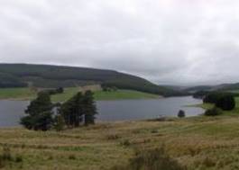
Backwater Reservoir Circuit (near Kirriemuir): Distance 7.3-miles. Accent 700ft. Around
3-hours. Conditions: easy track all of the way. Click the photo for a zipped file of gpx and kml. |
||||||||||
|
|
Cuilt Circuit
as an extension of Backwater, or as a separate route. Distance 5.3-miles. Accent 600ft. Around 2-hours, or around 4.5-hours combined. Conditions: easy track all of the way. Click the photo for a zipped file of gpx and kml. |
||||||||||
|
|
Bishop Hill via Glen Vale and Carlin Maggie (near
Auchtermuchty): Distance 6.5-miles. Accent 1100ft. Around
3-hours. Conditions: easy track all of the way. Click the photo for a zipped file of gpx and kml. |
||||||||||
|
|
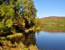
Loch Ordie and Deuchary Hill (near Dunkeld):
Distance 14.5-miles. Accent 2200ft. Around 6-hours. Conditions: a nice and varied walk near Dunkeld. Click the photo for a zipped file of gpx and kml. |
||||||||||
|
|
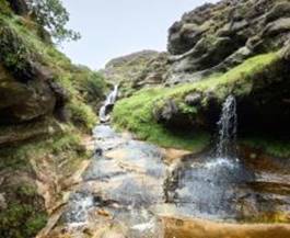
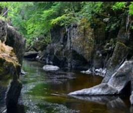
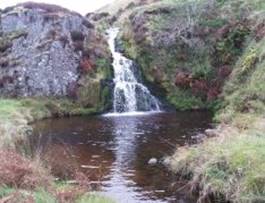
Rocks of Solitude (near Edzell):
Distance 6.5-miles. Accent 300ft. Around 2.5-hours. Conditions: an easy walk to a picturesque gorge. Click the photo for a zipped file of gpx and kml. |
||||||||||
|
The
Borders: |
|
||||||||||
|
|
Rhymer’s Route (near Melrose): Distance 11-miles.
Accent 1500ft. Around 5-hours. Conditions: well signposted on decent track
throughout. Click the photo for a zipped file of gpx and kml. |
||||||||||
|
|
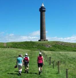
Jedburgh to Harestanes
and the Waterloo Monument. Distance 13-miles. Accent 1170ft. Around 5-hours. Conditions: easy to follow and decent track. Click the photo for a zipped file of gpx and kml. |
||||||||||
|
|
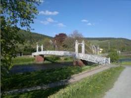
Kelso to Roxburgh. Distance 7-miles. Accent
400ft. Around 3-hours. Conditions: easy to follow river bank walk. Click the photo for a zipped file of gpx and kml. |
||||||||||
|
|
Glentress Circuit from Peebles. 6.5-miles. Accent 825ft. Around 3-hours. Conditions: easy to follow track and river bank. Click the photo for a zipped file of gpx and kml. |
||||||||||
|
|
Baddinsgill Circuit (near West Linton): Distance 9-miles. Accent 2000ft. Around
4-hours. Conditions: a little tricky to follow with some
tracks and open moor. Click the photo for a zipped file of gpx and kml. |
||||||||||
|
Northumberland: |
|
||||||||||
|
|
Davidson’s Linn and Border Walk (near Alwinton): Distance 10-miles. Accent 1800ft. Around
4.5-hours. Conditions: Cheviot hills classic. Some good
tracks and open moorland. Click the photo for a zipped file of gpx and kml. |
||||||||||
|
|
Davidson’s Linn direct. Distance 9-miles. Accent
1600ft. Around 4-hours. Conditions: as above but lower maximum elevation
– less windy. Click the photo for a zipped file of gpx and kml. |
||||||||||
|
|
Harthope Valley and Coldgate Circuit (near Wooler): Distance 9.5-miles. Accent 1270ft. Around
4-hours. Conditions: a classic Cheviot walk. Happy Valley
can be boggy. Click the photo for a zipped file of gpx and kml. |
||||||||||
|
The Lake
District: |
|
||||||||||
|
|
Skiddaw via Ullock Pike
(near Keswick): Distance 8.5-miles. Accent 2900ft. Around 4.5-hours. Conditions: a mountain walk
on some good tracks and open fell-side. Click the photo for a zipped file of gpx and kml. |
||||||||||
|
|
Grisdale Pike from Braithwaite (near Keswick): Distance 7-miles. Accent
2370ft. Around 4-hours. Conditions: a classic fell
walk on good tracks throughout. Click the photo for a zipped file of gpx and kml. |
||||||||||
|
|
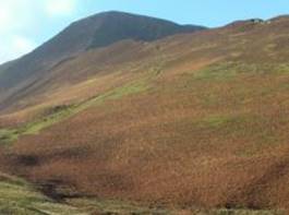
Grasmoor and Whiteless Pike (near Buttermere):
Distance 6-miles. Accent 2600ft. Around 3.5-hours. Conditions: a classic fell
walk on established tracks. Click the photo for a zipped file of gpx and kml. |
||||||||||
|
|
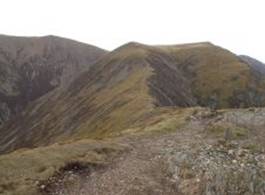
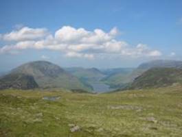
Fleetwith Pike and Haystacks (near Buttermere): Distance 5-miles. Accent
2250ft. Around 3-hours. Conditions: a classic Wainwright walk on
established tracks. Click the photo for a zipped file of gpx and kml. |
||||||||||
|
|
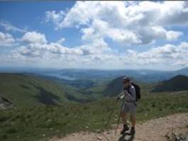
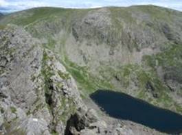
The Fairfield Horseshoe (near Grasmere): Distance 10.5-miles. Accent 3250ft. Around
5.5-hours. Conditions: a Lake District classic. Harder than
the above walks, but very satisfying. Click the photo for a zipped file of gpx and kml. |
||||||||||
|
|
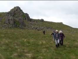
Coniston Old Man (near Coniston): Distance
7.5-miles. Accent 2450ft. Around 4-hours. Conditions: a less well-trod route up a classic
Lake District hill. Click the photo for a zipped file of gpx and kml. |
||||||||||